

- Located in southeast Wyoming near Laramie and is 300 miles from Jackson Hole
- Known locally as the Snowy Range
- The Snowy Range Scenic Byway winds up and over Snowy Range Pass, offering spectacular views and outdoor recreation
- Ryan Campground is also the site of a WWII Prisoner of War camp
Overview
For travelers coming from the east or the Denver area the Medicine Bow area is conveniently located in southeast Wyoming. This area offers outdoor recreation, a spectacular scenic byway, and vistas featuring alpine lakes and jagged peaks.
Seasonal Closures
From mile marker 35 to 48, Highway 130, or the Snowy Range Road, is closed due to snow from late Oct. to Memorial Day.
Highlights
Snowy Range Scenic Byway
The 29 mile Snowy Range Road, or Highway 130, is also known as the 'Great Skyroad'. It climbs sharply through lodgepole and spruce forests to Snowy Range Pass.
Snowy Range Pass
This pass sits at 10,847-feet, is the second highest in the state, and offers views of the Colorado mountains and alpine vegetation zones. In the winter, this pass is closed, but continues to be popular with snowmobilers, cross-country skiers, and snowshoeing. During the summer months, enjoy camping and hiking among alpine wildflowers, lakes, and peaks.
Hiking Trails
Despite lush vegetation and rugged scenery, hiking in the Medicine Bow Mountains is often overlooked. A recommended trail is the seven-mile loop to the summit (12,013 ft) of Medicine Bow Peak, which offers solitude, fields of alpine wildflowers in mid-summer, and views of the Snowy range.
Begin at Lake Marie trailhead, located 14 miles from the town of Centennial. The depths of pristine Lake Marie hide the remains of a 1950s plane crash. The trail then heads north along lakes and streams. As you turn west, you will begin climbing a set of rocky switchbacks leading to a ridgeline, which continues to the summit. From the top, enjoy views of the Snowy Range peaks to the north and Longs Peak and Mount Zirkel to the south.
Campgrounds
If driving along the Snowy Range Road, check out Ryan Park Campground. This campground was the site of a WWII Prisoner of War camp and offers a self-guided tour of the area.
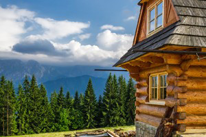
Twenty-five different Forest Service campgrounds dot the Medicine Bow Mountains. Most of these are open June-Oct., but the season varies depending on snow conditions. Summer is the busiest season, so it is recommended to arrive at most popular sites early in the day. The Forest Service also rents historic cabins in the area. Numerous mountain lodges are also available.
Getting Here
If traveling to Jackson from the east, leave I-80 at Laramie and continue west on State Hwy. 130. Highway 130 turns into the Snowy Range Scenic Byway, which travels into the heart of the Medicine Bow area. As you continue west, you will leave Medicine Bow National Forest and begin your trip north, entering the town of Saratoga and then to I-80.
