Gannett Peak, Highest in Wyoming

Table of Contents
Start Your Planning With These Local Businesses
Local Businesses





The Crown of Wyoming: A Local's Complete Guide to Climbing Gannett Peak
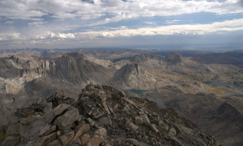
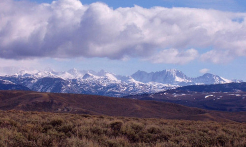
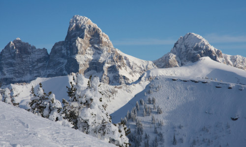
Wyoming's highest point sits at 13,804 feet, tucked so deep into the Wind River Range that most people have never heard of it. Gannett Peak doesn't have the name recognition of the Grand Teton (which it beats by 34 feet, if anyone's counting). What it has instead is something rarer: true wilderness.
We're talking 40 to 50 miles round-trip just to reach the base of the technical climbing. No roads. No shortcuts. No cell service. If something goes wrong out here, help is measured in days, not hours.
But here's the thing worth knowing before you plan anything: Gannett offers two completely different adventures. For experienced mountaineers with glacier skills, the summit is a legitimate test piece. For families and backpackers looking for something extraordinary without ropes and crampons, the trek into Titcomb Basin delivers some of the most spectacular alpine scenery in North America. Same trailhead. Same wilderness. Very different trips.
You just need to know which one you're actually signing up for.
Key Takeaways
- Titcomb Basin (no technical skills required): 30-34 miles round-trip to turquoise alpine lakes surrounded by 13,000-foot granite peaks. Perfect for fit families with older kids and experienced backpackers. Plan 3-5 days.
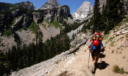
- Summit attempt (mountaineers only): 40-50 miles round-trip with glacier travel, crevasse hazards, and Class 3-4 scrambling on exposed ridges. Requires ice axe, crampons, rope work, and real experience. Plan 4-7 days.
- Best timing: Mid-July through early August offers the most stable conditions. Earlier means dangerous stream crossings. Later means the bergschrund (a critical snow bridge) may be impassable.
- The mosquitoes are legendary. Locals call them Wyoming's state bird. Pack DEET and a head net or you'll regret it.
- Bear canisters are mandatory, not optional. You won't find trees tall enough for a proper bear hang in the high basins.
- Altitude affects everyone. Your fitness level doesn't matter. Spend a day or two acclimatizing in Pinedale or Dubois before hitting the trail.
Why Gannett Peak Commands This Much Respect
The statistics tell part of the story. Gannett sits on the Continental Divide, straddling two designated wilderness areas (Bridger to the west, Fitzpatrick to the east). Its topographic prominence is over 7,000 feet, making it Wyoming's most dominant peak. You'd have to travel 290 miles to Longs Peak in Colorado to find higher ground.
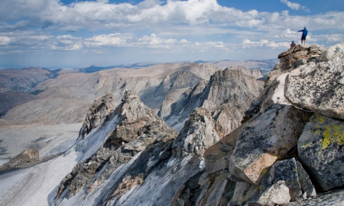
The mountain wears some of the largest remaining glaciers in the American Rockies. The Gannett Glacier sprawls across the northern face. The Gooseneck and Dinwoody Glaciers form the primary climbing routes. These aren't decorative ice patches. They're active, crevassed, and they shift every season.
But statistics miss the point. What makes Gannett different is the approach. By the time you reach the base of the technical climbing, you've already hiked a marathon through remote wilderness. Then the real work begins. This combination of distance and technicality is why Gannett consistently ranks among the most demanding state highpoints, typically listed just behind Denali and Montana's Granite Peak.
The Family-Friendly Adventure: Backpacking Titcomb Basin
Let's start with the trip most people can actually do.
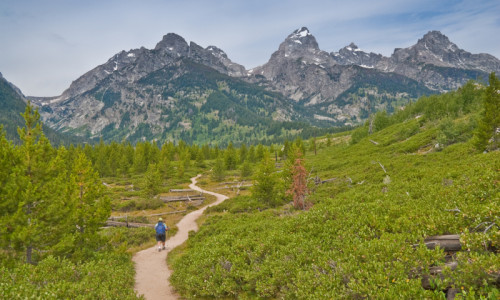
Titcomb Basin isn't a consolation prize. It's one of the premier backpacking destinations in North America, full stop. We're talking a glacially carved granite cathedral, flanked by jagged peaks, dotted with lakes so blue they look photoshopped. You set up camp and just stare.
The trek from Elkhart Park Trailhead (near Pinedale) covers roughly 15-17 miles one way. The trail is well-defined, though rocky in sections and muddy after rain. Total elevation gain is manageable, but the high altitude and rolling terrain will humble you if you're not prepared.
Is This Trip Right for Your Family?
This works for fit families with kids roughly 10 and older who have backpacking experience. Younger kids can handle it if they're seasoned hikers, but be honest about their abilities. The altitude (you'll camp above 10,000 feet) affects everyone differently, and there's no easy bailout once you're deep in the basin.
What to expect:
- Day 1: Hike 10-12 miles to Island Lake. Stop at Photographer's Point around mile 4.5 for your first jaw-dropping view.
- Day 2: Push 4-5 miles into Titcomb Basin proper. Set up base camp.
- Day 3: Explore. Fish for trout (bring a Wyoming license). Photograph everything. Day hike toward Bonney Pass for views of Gannett itself.
- Day 4-5: Hike out.
The Honest Assessment
The mosquitoes in July and August will test your family's patience. Seriously. Weather can turn violent without much warning, so pack layers and rain gear even if the forecast looks perfect. And the altitude will slow everyone down more than you'd expect.
That said, watching your kids take in this landscape? Standing together at the edge of a turquoise lake with nothing but granite and sky around you? That's the stuff family adventure memories are made of.
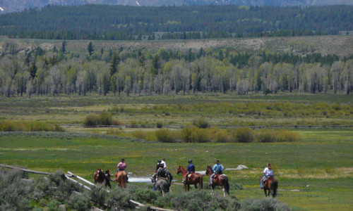
Ready to plan your trip? The Pinedale Ranger District can answer specific questions, and several local outfitters offer "spot pack" services where they haul your gear to base camp by horse while you hike in with just daypacks. Worth considering if you want to lighten the load.
The Summit Route: What Mountaineers Need to Know
If you're reading this section, we're assuming you have glacier travel experience, know how to self-arrest with an ice axe, and understand what "no-fall zone" actually means. If those terms are unfamiliar, this climb isn't for you yet. (Consider hiring a guide service or building skills on less remote objectives first.)
Choosing Your Approach: Pinedale vs. Dubois
Two primary routes lead to the summit, and they offer fundamentally different experiences.
| Feature | Pinedale (West) | Dubois (East) |
|---|---|---|
| Distance | ~40-44 miles RT | ~50-54 miles RT |
| Elevation Gain | ~9,000-11,000 ft | ~10,500-11,000 ft |
| Duration | 4-6 days | 5-7 days |
| Character | Stunning scenery through Titcomb Basin. More people on trail. | Wilder, more solitary. Major stream crossings. |
| Summit Day | Brutal. You climb 2,100 ft up Bonney Pass, descend to the glacier, summit, then re-climb 1,200 ft back over the pass. | More manageable. Direct route to the glacier without the double-pass punishment. |
The short version: Pinedale is prettier but beats you up on summit day. Dubois is longer overall but spreads the suffering more evenly.
The Gooseneck Route (Final Push from Both Approaches)
Regardless of how you arrive, the last 3,000 vertical feet follow the same path up the Gooseneck Glacier. This is where things get real.
The bergschrund is the technical crux. Early season, you might walk across a solid snow bridge. Late season, that bridge collapses, leaving a gap that requires exposed Class 3-4 rock climbing or technical ice work to bypass. Conditions change week by week, sometimes day by day. Check recent trip reports before you go.
Above the bergschrund, a steep snow couloir leads to loose rock scrambling and a knife-edge summit ridge. The exposure is spectacular and unforgiving. There's no margin for error.
When to Go
Mid-July to early August is prime time. Days are long, weather is relatively stable (afternoon storms still happen), and the bergschrund snow bridge is usually intact.
Late June to early July offers fewer bugs and more consolidated snow, but stream crossings on the Dubois route can be dangerous or impassable.
Late August to September means the bergschrund is likely wide open and the weather becomes unpredictable. The window is narrowing, not expanding.
The Risks You're Actually Managing
The remoteness amplifies everything. A twisted ankle that's annoying on most trails becomes a potential multi-day evacuation here.
Altitude Sickness
At 12,000+ feet, you're breathing air with roughly 40% less oxygen than sea level. Your fitness level is irrelevant. Altitude sickness is a physiological response, not a conditioning issue.
Know the warning signs:
- Acute Mountain Sickness (AMS): Headache, nausea, dizziness, fatigue. Uncomfortable but manageable if you stop ascending.
- HAPE (fluid in lungs): Extreme fatigue, breathlessness at rest, wet cough. This is an emergency. Descend immediately.
- HACE (fluid in brain): Severe headache, confusion, loss of coordination. Life-threatening. Descend immediately.
The rule is absolute: do not ascend further with moderate to severe symptoms. Summits wait. Brain damage doesn't.
Weather
Clear mornings, building afternoon clouds, then lightning, hail, and rain. That's the daily summer pattern. Start summit days at 1-2 a.m. (yes, really) to be off exposed terrain before storms roll in.
Bears
You're in grizzly country. Bear spray is essential. Proper food storage is mandatory under Forest Service regulations. In the treeless alpine basins, a bear canister is the only practical solution. You can rent them from the Pinedale Ranger District or local outdoor shops.
Acclimatization: The Non-Negotiable
Don't fly into Jackson from sea level and head straight to the trail. That's asking for trouble.
Spend a day or two in Pinedale (7,175 ft) or Dubois (6,917 ft) doing easy hikes. Walk around Fremont Lake. Hike to Photographer's Point and back. Let your body adjust before asking it to perform at altitude.
The golden rule: climb high, sleep low. Above 9,000 feet, don't increase your sleeping elevation by more than 1,500 feet per night. Drink 3-4 quarts of water daily. Skip alcohol for the first 48 hours.
Essential Gear Checklist
For Summit Attempts
- Ice axe and crampons (compatible with your boots)
- Helmet (rockfall and icefall are real)
- Rope and harness (30-60m for glacier travel and potential rappels)
- Navigation: map, compass, GPS or satellite communicator
For Everyone
- 3-4 season tent (high winds and potential snow even in summer)
- Sleeping bag rated to 20°F or lower
- Bear canister (mandatory) and bear spray
- Headlamp with extra batteries
- Water filter and comprehensive first-aid kit
- Layers: base layer, fleece, insulated jacket, waterproof shell. No cotton.
Wilderness Regulations
Permits: Small private groups (under 15) don't need a climbing permit for standard routes. Sign trailhead registers. Organized groups and anyone using pack animals overnight require permits.
Food storage: Mandatory. All food, garbage, and scented items in a bear canister or proper hang (10 ft up, 4 ft out). In practice, the treeless basins make hanging impossible.
Campsites: At least 200 feet from lakes and trails.
Group size: Maximum 15 people in the Bridger Wilderness.
Should You Hire a Guide?
For the summit? Unless you're an experienced mountaineering party with glacier skills, yes. A guide service provides route-finding expertise, risk assessment, technical gear, and dramatically increases your summit chances. They handle logistics so you can focus on climbing.
For Titcomb Basin backpacking? Not necessary if you have backcountry experience, but "spot pack" services (where horses carry your gear to base camp) make the trip significantly easier on your body.
Finding guides: The Pinedale and Dubois Ranger Districts maintain lists of licensed outfitters. Many reputable services operate out of Jackson, Pinedale, and Dubois.
Frequently Asked Questions
How difficult is Gannett Peak really?
It's consistently ranked among the hardest state highpoints in the Lower 48. The difficulty isn't extreme technical climbing. It's the combination of 40-50 mile approach, high altitude, glacier travel, and exposed scrambling in a place where help is days away.
Can families do anything here without mountaineering skills?
Absolutely. The backpacking trip to Titcomb Basin is world-class. It's strenuous and high-altitude, but no technical skills required. Fit families with older kids (roughly 10+) and backcountry experience will find it challenging and rewarding.
What's the best time to go?
Mid-July through early August. Earlier means dangerous stream crossings on the Dubois route. Later means the bergschrund may be impassable without technical ice climbing.
Do I really need a bear canister?
Yes. It's mandatory under Forest Service regulations, and you won't find suitable trees for hanging food in the alpine basins anyway.
Which approach is better for the summit: Pinedale or Dubois?
Depends on what you value. Pinedale is shorter with stunning scenery but involves a brutal double-crossing of Bonney Pass on summit day. Dubois is longer and wilder with challenging stream crossings but a more manageable summit day.
How much does this trip cost?
Budget roughly $300-500 per person for self-supported trips (gear rentals, permits, gas, food). Guided expeditions typically run $2,000-4,000+ depending on services included. Spot pack services for gear hauling usually cost $200-400.
The Bottom Line
Gannett Peak isn't for everyone. The Wind River Range is.
Whether you're a mountaineer chasing Wyoming's highest summit or a family looking to camp beside turquoise alpine lakes, this place delivers. Start where your experience and fitness actually are, not where you wish they were. Hike to Photographer's Point. Spend a night at Island Lake. Let the high mountain air settle into your bones.
The bigger adventure will make itself clear when you're ready.