


- Summit elevation 11,239 feet.
- Located in the Gros Ventres Range south of Jackson Hole Valley.
- Named for the local bighorn sheep and its distinct shape.
- Ideal for summer hiking and camping trips.
- Most common access points are Flat Creek Trailhead and Red Hills Campground.
Overview
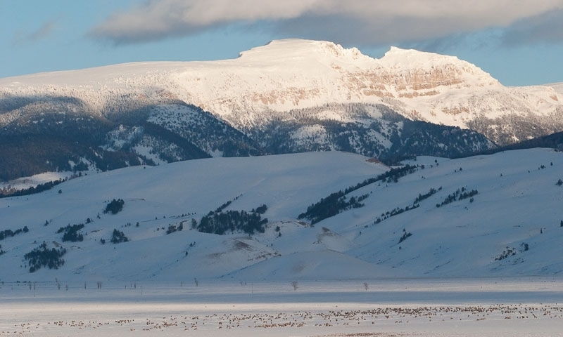
Sheep Mountain, part of the Gros Ventres Range, is a peak easily seen to the east of Jackson Hole in the Gros Ventres Wilderness. While its official name is Sheep Mountain, many locals know it only as Sleeping Indian Mountain or the Sleeping Indian; visitors will quickly see why, as it has a distinct resemblance to a Native American, complete with headdress, lying on his back with his arms crossed on his chest.
Gros Ventre Slide
Sheep Mountain was also the site of the Gros Ventre Slide, one of the largest landslides in recent history. This huge slide carried around 50,000,000 cubic yards of rock, soil and debris down the north face of Sheep Mountain and dammed the Gros Ventres River, creating Lower Slide Lake.
Hiking
While Sheep Mountain doesn’t see a large amount of foot traffic, it is well worth the trip for the view from the summit and the novelty of being on top of such a distinct point, as well as the hike itself. The highest point of Sheep Mountain, 11,239 feet, is located where the Indian’s arms appear to be crossed over his chest. There are many ways to summit Sheep Mountain; two of the more common routes begin at Flat Creek Trailhead and from the Red Hills Campground.
- The Flat Creek Trailhead is accessible from the National Elk Refuge Road, about 15 miles outside of Jackson. The road is not well-maintained the entire way and requires a vehicle with high clearance and 4WD. From the car, the trail is about seven miles, one-way, with just under 4,200 feet of elevation gain.
- Getting to the Red Hills Campground is much easier. From Kelly, Wyoming, take Gros Ventres Road north and east, about 1/3 mile past the junction of Antelope Flats and Gros Ventres Road. The Red Hills Campground is directly across the road from the trailhead. This trail begins as a two-track before turning into a single track that climbs up the north end of Sheep Mountain. This trail also provides easy access to Blue Miner and Grizzly Lakes. From the car, the trail is 11 miles, one-way, with just over 4,200 feet of elevation gain.
Camping
Camp along the banks of Slide Lake at Atherton Creek Campground. If you are backpacking, backcountry camping near Blue Miners Lake is a nice option.
Maps
Depending on where on Sheep Mountain you’re heading, you may want to bring a copy of the Blue Miner Lake, Grizzly Lake and Gros Ventres Junction USGS Quads.